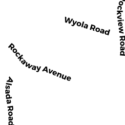
0 WYOLA RD
Owner Information
HULL TOWN OF
253 ATLANTIC AVE
HULL, MA 02045-0000


Property Details
0 WYOLA RD is classified as a Vacant, Selectmen or City Council (Municipal).
0 WYOLA RD is valued at $446,800. The land is valued at $446,800 and the structures are valued at $0.
This property is in Zone SFC. Confirm with local Zoning Board authorities to ensure there are no overlays or other easements on this property.
The most recent deed for 0 WYOLA RD is recorded at the local registrar in Book 4105, Page 45. 0 WYOLA RD was last sold on Wednesday, October 1, 1975 for $0.
Assessment data from fiscal year 2022.
Flood Data
This property is partially within the AE Zone (within floodplain). Approximately 0.49 acres (98.29%) of the property is within this zone.
The base flood elevation for this flood zone is 10 feet.
This information is sourced from the FEMA National Flood Hazard Layer. See our full disclamer.
Broadband Internet Providers
| Provider | Type | Bandwidth (mbps) | |
|---|---|---|---|
| Verizon New England Inc. | Fiber | 940 | 880 |
| Viasat Inc | Satellite | 100 | 3 |
| VSAT Systems, LLC. | Satellite | 2 | 1 |
| HughesNet | Satellite | 25 | 3 |
| GCI Communication Corp. | Satellite | 0 | 0 |
| Comcast | Cable | 1000 | 35 |
| Verizon New England Inc. | DSL | 1 | 0 |
Broadband service provider data from December 2020.
Adjacent Properties
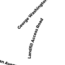
- 1 LANDFILL ACCESS RD
Other Storage, Warehouse, and Distribution facilities (see also usecode 401) owned by ESI ADVANCED WIRELESS NETWORKS LLC - 0 WYOLA RD
Undevelopable Residential Land owned by SEXENY GEORGE - 0 WYOLA RD
Vacant, Selectmen or City Council (Municipal) owned by HULL TOWN OF - 72 WYOLA RD
Two-Family Residential owned by LUGGELLE KATHLEEN M TRS THE MA RLYN REALTY TRUST - 56 WYOLA RD
Single Family Residential owned by KELLY BARTLEY - 58 WYOLA RD
Single Family Residential owned by GOOD CRAIG - 64 WYOLA RD
Single Family Residential owned by ST GEORGE BRADLEY - 0 ROCKLAND CIRCLE
Potentially Developable Commercial Land owned by VINTON RAYMOND B TRS TWO-A RL TY TRUST